Lagodekhi
Georgian-Italian Lagodekhi Archaeological Project (GILAP)


The "Georgian-Italian Lagodekhi Archaeological Project" is a project (summer 2018-) of Ca' Foscari University of Venice in collaboration with the Municipality and Museum of Lagodekhi, which aims to investigate and promote the archaeological heritage of the Municipality territory. The project is directed by Elena Rova for the Italian side and by Davit Kvavadze, with the support of Davit Darejanashvili, for the Georgian side.
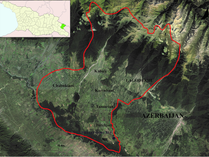
The Municipality of Lagodekhi is located in the eastern part of Georgia, not far from the border with Azerbaijan, and covers an area of about 900 km2 between the foothills of the Greater Caucasus and the valley of the Alazani River. It is one of the richest areas of Georgia, from the point of view of both its natural landscape and its historical and artistic heritage. Besides important remains of the Medieval period, it is especially known for the presence of monumental barrows graves (kurgans) dated to the second half of the 3rd millennium BC and for that of numerous sites of the Chalcolithic period (5th-4th millennium BC), which are rather rare in the rest of the country.
The project has a regional perspective, i.e. it is not focused on a single site, but on the relationships between different sites (large and small settlements, necropolises, etc.), on the diachronic development of the relations between human groups and the natural environment and between the local communities and those living in other regions of the Near East. The approach is multi- and interdisciplinary and involves the participation in the annual campaigns in Georgia and in associated research activities (laboratory analyses, etc.) of experts from different disciplines. Italian and Georgian researchers, students, PhD students as well as international experts take part in the annual campaigns on the field.
The first aim of the project is to map all the archaeological sites on the territory of the Municipality through a survey with the help of remote sensing (analysis of aerial and satellite photos), the study of previous publications and information by the local population, in order to investigate the development of human settlement on the territory and to provide local authorities with a tool for its protection and valorisation.
Special attention will be devoted to the late prehistoric and protohistoric cultures of the Chalcolithic, Bronze and Iron Ages (5th- first half of 1st millennium BC). These will be investigated through excavations and surveys at different sites of the Municipality, with the aim, among others, to define a reliable relative and absolute regional chronology and to investigate how the different human groups that occupied the region in the course of time exploited the territory.
In 2018 excavations were started at the Chalcolithic site of Tsiteli Gorebi 5; other topic of scientific interest have been identified in the Early Kurgan cultures of the second half of the 3rd millennium BC and in those of the Late Bronze / Early Iron Age (second half of the 2nd - beginning of the 1st millennium BC).
 Sites
Sites
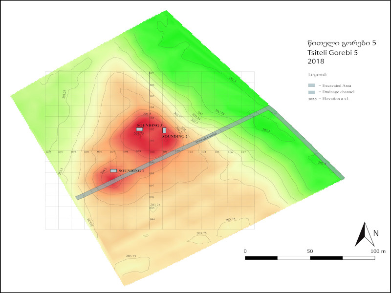
Tsiteli Gorebi 5
The site of Tsiteli Gorebi 5 (41°40'19.89" N 46°11'14.22" E) is located in the Lagodekhi Municipality of the Kakheti region. It lies ca 4.5km to the SE of the present Tsitelgori/Ulianovka village, at ca. 204m a.s.l. It is one of a cluster of Chalcolithic sites (Tsiteli Gorebi 1, 2, 4, Tsiteli Gorebi 3/Kvitiatskhali, Damtsvari Gora), some of which were excavated in the 1970s by V. Varazashvili. Since it was impossible to locate all the different sites mentioned in the old publications, it was decided to assign this hitherto unknown Chalcolithic site the name of Tsiteli Gorebi 5.
The settlement consists of a low mounded area, oriented NE-SW, which emerges for less than 1.50m on the surrounding plain, and extends on a maximal surface of ca 1.60ha. The site has been subjected to repeated ploughing, which probably flattened its top and spread archaeological materials over the surrounding area. It is characterised by two low elevations, a larger one to the NE and a smaller one to the SW, separated by a 20m wide slightly depressed area. A modern drainage channel running SW-NE cuts the site's southern part.
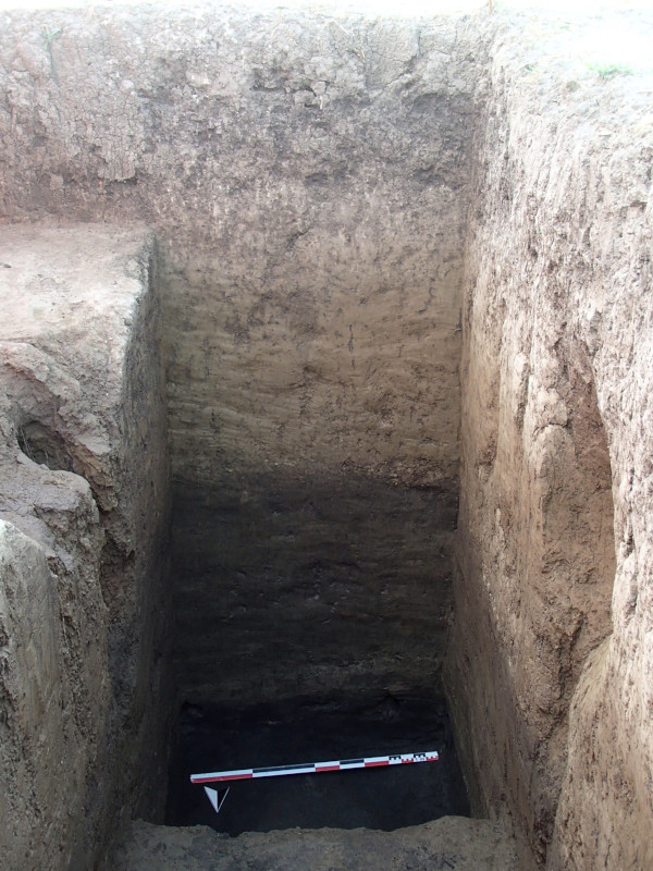
The archaeological remains over the whole settlement area appear to have been deeply affected by a combination of different post-depositional elements, among which deep-ploughing, repeated flooding and earth-worms activities, which moved most of the finds from their original context of deposition. A preliminary sounding ascertained that archaeological material concentrate in the uppermost 90cm of the stratigraphic sequence, the remaining of which was composed of natural deposits. The recovered assemblage, mostly consisting of small potsherds and chipped lithics (almost exclusively obsidian) is remarkably homogeneous, and suggests a single-period occupation, possibly dating to the first half of, or to the mid-5th millennium BC.
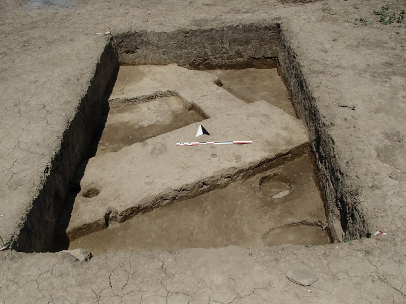
Soundings carried out in 2018 in the northern part of the site unearthed parts of poorly preserved architectural features (walls and platforms) in compacted clay or blocks of clay ("bricks") of squarish shape, whose considerable dimensions suggest the presence at the site of large-scale architecture, so far unattested in the Chalcolithic period in the region.
Tchiauri
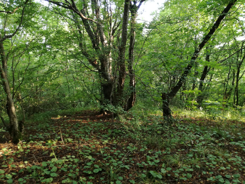
The Tchiauri cluster is located in the territory of Tchiauri (Georgian ჭიაური) village, formerly known as Ulianovka. It lies in the eastern part of Lagodekhi Municipality, not far from the Azerbaijani border, in the flat plain just north of the Alazani river, just a few kilometres to the northwest of the Tsiteli Gorebi cluster. The area is surrounded by wheat and corn fields alternating with open areas mainly used for cattle breeding and with recent artificial basins for drainage, water storage and recreational fishing. Patches of low forest and shrub are scattered all around; the closer one gets to the course of the Alazani they turn into thick lowland forest. The entire territory is easily flooded during the rainy season.
The cluster was discovered during the 2021 survey of the GILAP project. It consists of two low mounds (Tchiauri 1 and 2) and at least two additional concentrations of pottery sherds in close-by fields (Tchiauri 3 and site LS095); archaeological material was also found, according to local informants, on another field east of Tchiauri 1, but this could not be surveyed because it was under cultivation. The cluster appears to have been mainly settled during the Late Bronze/Early Iron period (late 2nd-early 1st millennium BC), with sporadic traces of later (Hellenistic to late Medieval) occupation.
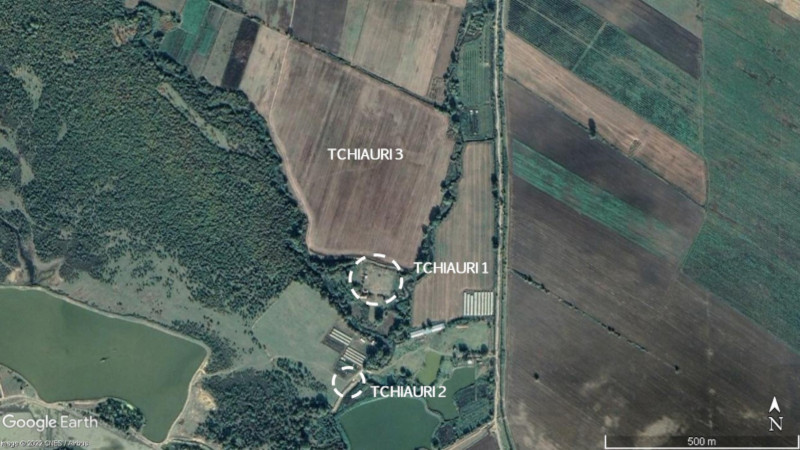
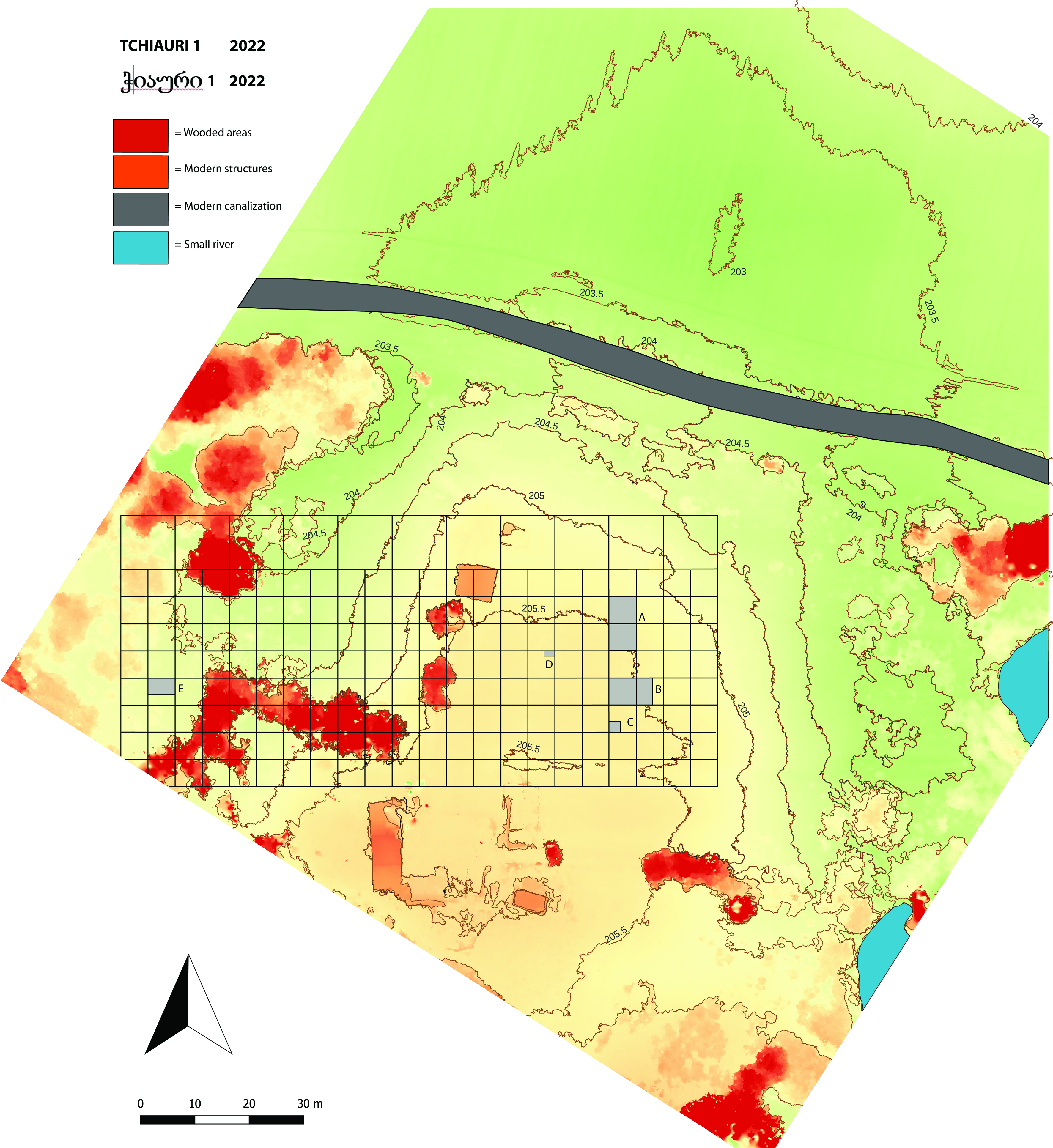
The main site, Tchiauri 1 (LS084, UTM 38T 575816.97 E, 4615387 N) consists of a low mound, roughly circular in shape with a flat top, which rises for about 2 meters on the surrounding plain at ca. 205.50 m a.s.l.
The mounded area is presently slightly larger than 1 ha, but its exact limits are difficult to reconstruct because of the thick vegetation and intensive modern manipulation (excavation of small basins, ploughing etc.).
Surface material, collected in 2021 and again in 2022, suggested a possible Chalcolithic presence, followed by settlement occupation during the (Middle) and Late Bronze/Early Iron Age, and more sporadic presences (graves, pits, etc.) during the Hellenistic/Roman and Medieval periods.
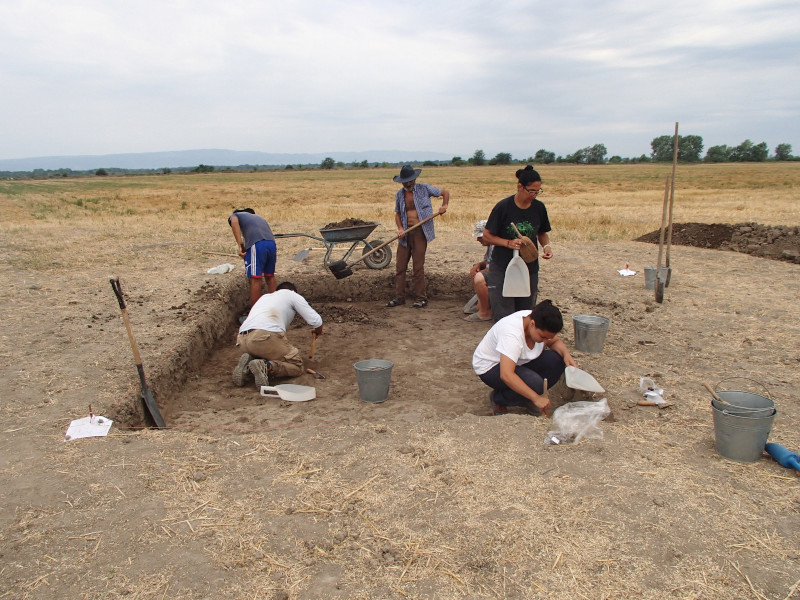
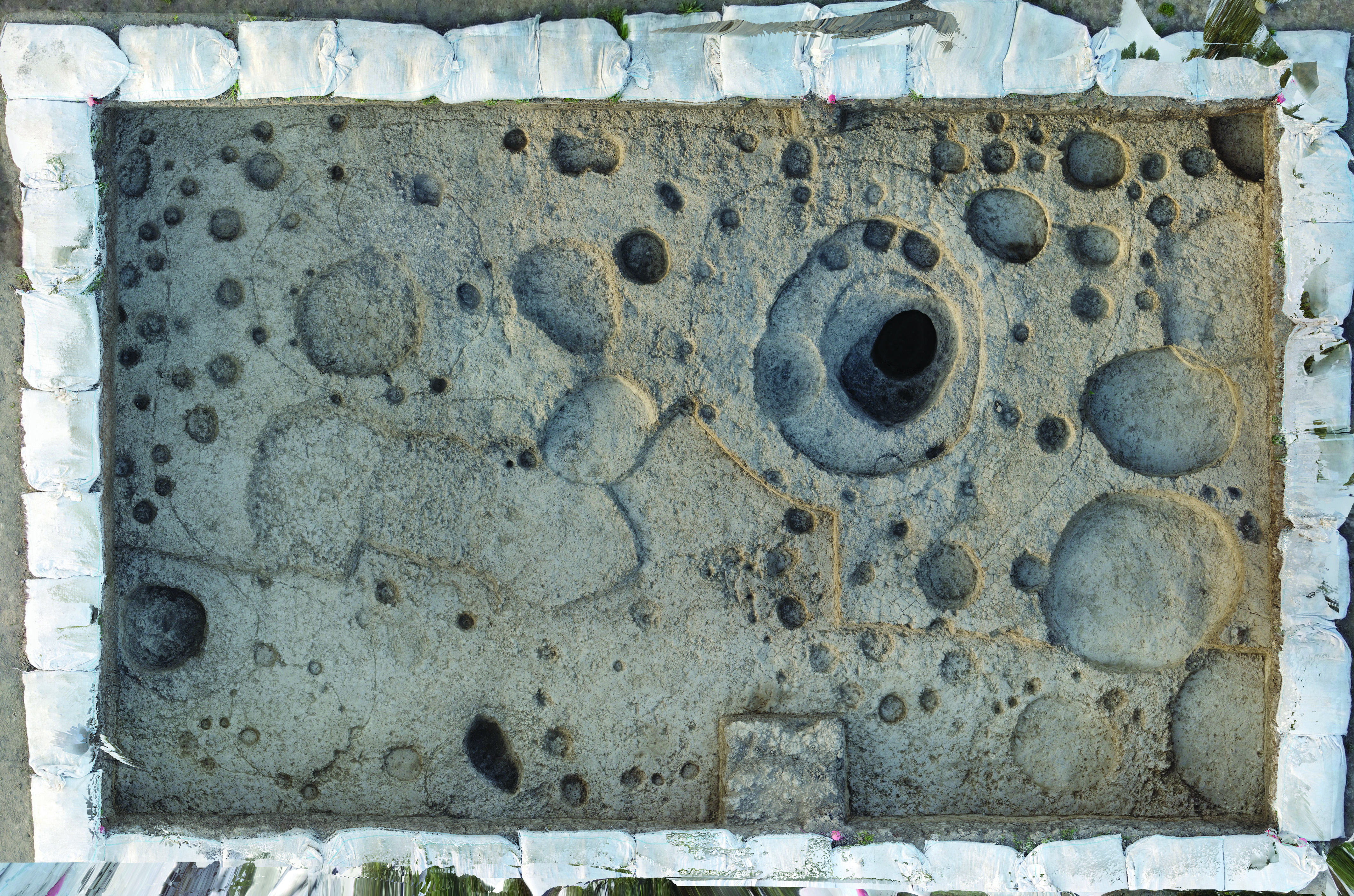
In June/July 2022 excavations were carried out for ca 5 weeks on the site. Five small excavation areas (A, B, C, D and E) were opened on its top with the aim to verify the date and preservation of the archaeological remains.
Unfortunately, the area turned out to have been heavily disturbed by modern agricultural activities and by ancient and modern pits.
Fields C, D and E yielded only few pottery sherds within a thick sequence of layers of alluvial origin.
The stratigraphic sequences of Fields A and B were very similar to each other.
We found evidence of repeated ploughing and planting, which had completely destroyed the later anthropic occupation, leaving behind only a 30-40cm-thick layer of greyish granular sediments containing mixed Iron Age, Hellenistic and Medieval material.
Modern ploughing had also affected the top of the LB/EIA level, which was no more than 20 cm thick and rested directly on a sequence of archaeologically sterile alluvial sediments. It can thus be suggested that areas A and B were sort of small “islands” of LB/EIA occupation, slightly elevated above the otherwise unsettled (and easily flooded ?) alluvial plain.
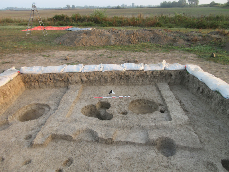
The structures found in these excavation areas were rather peculiar. In Field A we found some remains of poorly preserved rectilinear mudbrick (?) walls without stone foundations with no evident associated floor.
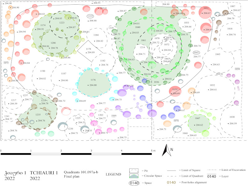
Under these, the remains of what was apparently the earliest and main occupation of both areas A and B were better preserved. They consisted of light, ephemeral structures made of perishable materials – wood, reed, rush, etc. –, which had often been re-built so that their only remains were several series of superimposed post-holes. They were standing on small elevated areas possibly delimited by wooden fences, and consisted of circular spaces surrounded by irregular circles of post-holes.
These rounded structures occurred in two dimensional ranges: large and small.
The larger ones (1.50 to ca 3 meters in diameter) consisted of very shallow flat-based pits (depth was 10-15 cm), generally topped by a layer of compact soil, surrounded by circles of poles with a diameter of 12-16 cm, generally not perfectly centred on the pit’s perimeter.
No traces of possible wall bases – either in stones or clay – were observed around them, as well as no traces of possible roofing. For sure, these slightly sunken structures were frequently dismantled, possibly filled-in and re-built approximately in the same position, thereby cutting into the earlier pits.
No floor or well defined surface was found at the bottom of these spaces.
Small pits cutting the large circles were occasionally found inside these: they contained a small amount of archaeological materials (pottery sherds, obsidian, animal bones).
The precise function of these spaces is difficult to identify; rather then as proper dwellings, they might have been used as storage structures or areas dedicated to temporary activities. They probably had a simple, tent-like conical shape and were entirely constructed of locally available perishable materials (wood, branches, reeds, and straw).
Structures of the second dimensional class were similar but much smaller (they measured only 70-100 cm in diameter): the diameter of the surrounding “poles” was 6 cm or less. They were sometimes located inside the larger ones, but never in their centre.
These structures may have been storage or drying facilities with a raised floor, although considering their small size it is difficult to hypothesise what might have been stored in them.
Structures of neither type have been excavated so far at other sites of the Kakheti region, either contemporary with Tchiauri 1 or not, with the exception of Didi Gora located a few km to the south: we thus suppose they represent a peculiarity of the swampy or easily flooded environment that characterises this part of the Alazani valley.
In the LB/EIA they were probably used as auxiliary features for isolated buildings located in their proximity.
An exploratory trench (Field A) of 1 x 5 m was also excavated at Tchiauri 2 (LS093, UTM 38T 595716.74 E 4615102.66 N), another low mound which lies at a distance of ca 300 m to the SW of Tchiauri 1. The general stratigraphy of the excavated area was similar to that already described for Tchiauri 1, and equally disturbed.
A third site of the cluster (Tchiauri 3, LS094) was identified on a large ploughed field, extending for approximately 18 ha just N of Tchiauri 1. No excavations were carried out there, but it was the object of intensive surface collection, which yielded pottery sherds preliminarily attributed to the (Chalcolithic, Middle Bronze), Late Bronze, Iron Age, Hellenistic and Medieval periods.
Lagodekhi Survey
The Lagodekhi survey was started in 2018 by the Georgian-Italian expedition in collaboration with Dr. Kristen Hopper of Durham University (UK). The aim of the survey is to map the archaeological remains of the Lagodekhi Municipality in the Kakheti province of Georgia in order to reconstruct the development of human settlement in the region and to provide local authorities with a tool for its protection and valorisation. The Municipality extends over an area of ca 900km2 at the eastern limit of Georgia, near the present border with Azerbaijan. It is situated between the foothills of the Greater Caucasus range and the valley of the Alazani River, one of the main tributaries of the Kura. The survey area covers a diverse range of environmental zones, like forested foothills, alluvial fans, small river valleys, cultivated plains and a wide belt of dense lowland forest near the left bank of the Alazani River.
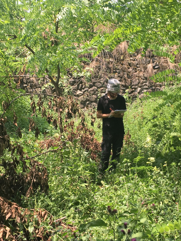
The Alazani Plain has been heavily cultivated and irrigated through time. Traces of canal systems dating back to Antiquity have been a source of interest to geographers and archaeologists from the early 20th century. Significant changes to the landscape can clearly be traced throughout the second half of the 20th century as, like in many other regions of the Southern Caucasus, agricultural intensification throughout the Soviet period (especially collectivised agriculture, deep ploughing, and the construction of irrigation systems) has resulted in a very different landscape from that of the past. These factors, in addition to the heavily vegetated landscape, significantly affect our ability to read the archaeological record, and require carefully devised survey strategies.
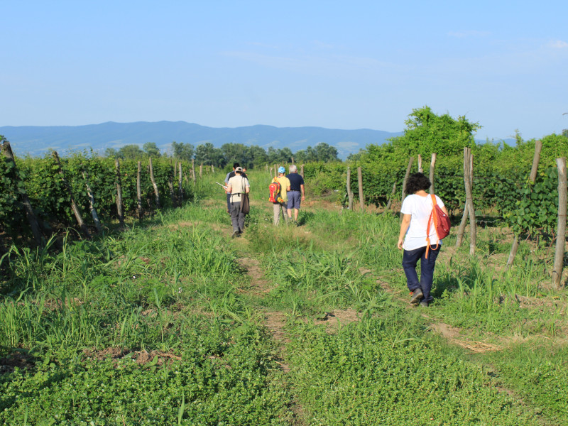
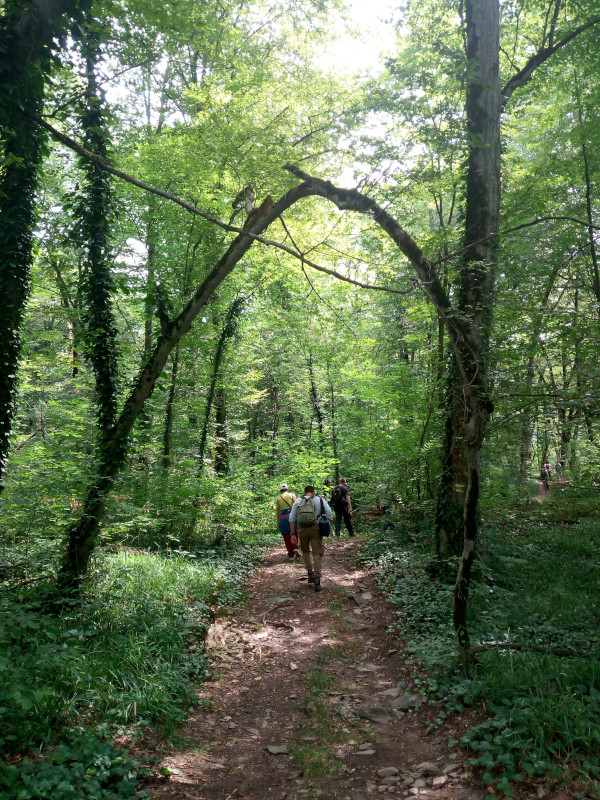
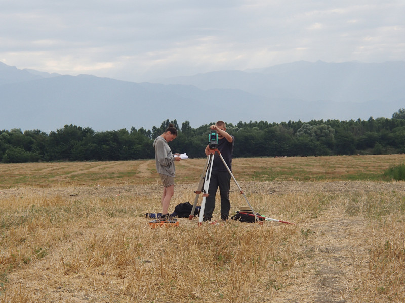
The methodology employed so far involves both extensive and systematic intensive pedestrian survey (transects) guided by the remote sensing of satellite imagery and aerial photos, published literature, and local knowledge.
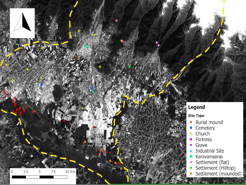
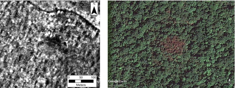
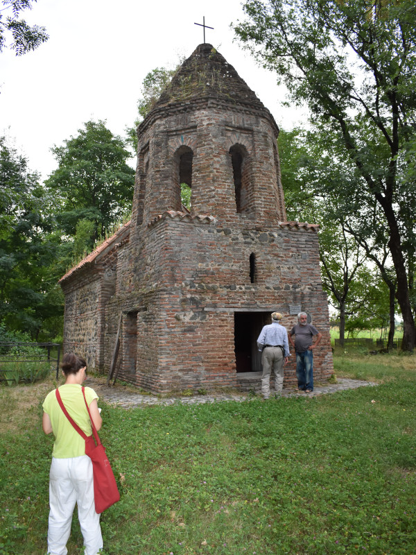
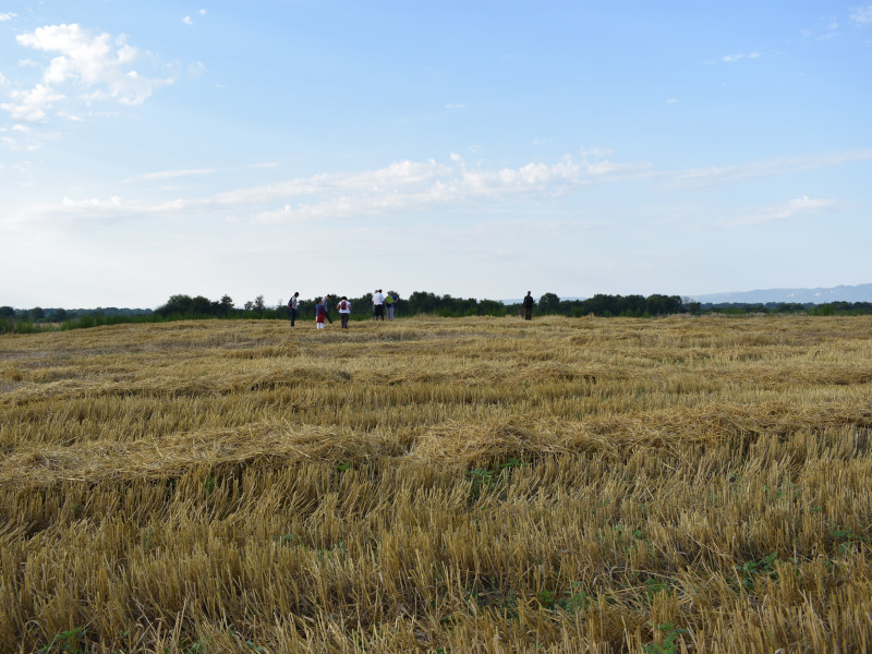
The 2018 survey resulted in recording the locations of 70 archaeological sites of different periods, which varied in altitude from ca 200 to ca 700 m a.s.l. and ranged from Medieval churches to low mounded sites that likely represent Chalcolithic settlements. Of special interest appears the concentration of large kurgans (monumental barrows), most of which presumably belonging to the later 3rd millennium BC Early Kurgan cultures, at the northern border of the forest flanking the Alazani river in the Chabukhiani/Ananauri area, about 30 of which have been mapped up till now. On imagery, kurgans on the cultivated plain either appear as small circular mounds or as areas of vegetation that have been avoided by ploughing or possibly, in cases when they had been completely ploughed out, by roughly circular soil discolourations. Kurgans located in forested areas are sometimes visible on the modern high resolution imagery because of visible differences in vegetation growth on top of the kurgan.