Gardabani
Georgian-Italian Gardabani Archaeological Project (GIGAP)


The “Georgian-Italian Gardabani Archaeological Project" (GIGAP) is a collaborative research, launched in 2023 by Ca' Foscari University of Venice and Ilia State University (Tbilisi). It is directed by Elena Rova for the Italian side and by Mariam Eloshvili for the Georgian side.
It focuses on the southern part of the Gardabani municipality (Kvemo Kartli region), close to the present border with Azerbaijan, between the Kura River, the main watercourse of Georgia, and the so-called “coloured mountains” of Mravaltskaro, which mark the limit between Kvemo Kartli and Kakheti. The area is divided between the fertile and intensively cultivated Kura plain, to the west, and the more arid and undulating landscape to the east. At its southern limit, an artificial lake, Jandara reservoir, lies at the border between these two parts of the territory and, at the same time, on the present Georgian-Azerbaijani border.
Contrary to all the surrounding regions, thus far this area has received little attention by archaeologists, although its very strategic location – in a natural corridor between Armenia and Azerbaijan on one side and Georgia on the other side – suggests that it has a high archaeological potential. Indeed, the well known Late Chalcolithic sites of Soyuk Bulaq and Boyuk Kesik are located just a few kilometres south of it, beyond the border with Azerbaijan, while many important sites of different periods have been discovered in the Marneuli plain to the west and in the area of Udabno to the east.
The project is foreseen to develop over a number of years, and include archaeological excavations, surface investigations, museum work and palaeoenvironmental research. Following the tradition of the GISKAP and GILAP projects, it aims at reconstructing, in a long-term diacronic perspective, the changing relations between the human groups which occupied the territory and their natural environment. The approach is multi - and interdisciplinary and involves the participation to the annual campaigns in Georgia and to associated research activities (laboratory analyses, etc.) of Georgian and Italian researchers, PhD students and students as well as of international experts of different disciplines.
Regular field activities will begin in 2024. The first object of excavation will be a large kurgan field located north-east of Lemshveniera village, where more than 60 barrows have been recorded during a preliminary field season in Autumn 2023. A systematic survey of the surrounding area is also being implemented.

 Sites
Sites
Gardabani kurgan field
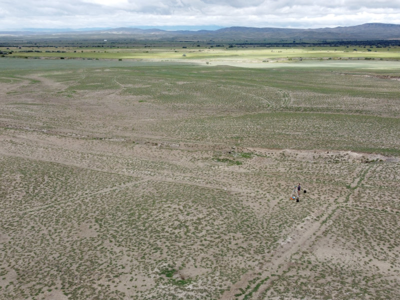
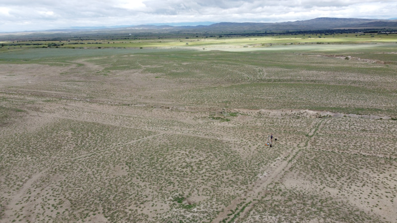
Gardabani kurgan field lies at a distance of ca 12 km to the NE of Gardabani as the crow flies. Its approximate centre lies at UTM 516786.00 m E, 4596679 m N, 426 m a.s.l. The site occupies a small plateau delimited by the rivers Jangirsu (to the north) and Gezaldere (to the south) and bordered to the south by some bare, undulating hills which continue until the border with Azerbaijan. It extends over an area of ca 40 hectares, gently sloping from NE toward SW; its elevation varies from 435 to 420 m. a.s.l.
The climate of the region is very dry. Nowadays spontaneous vegetation merely consists of low sparse patches of grass and the area is completely devoid of trees, uncultivated and mainly used for grazing by small groups of Azeri shepherds. In Soviet times, however, the territory was more intensively exploited, as shown by the remains of several farms for large-scale intensive cattle-breeding, one of which is located just south of the kurgan field, and another, larger one, ca 2 km to the south. There are also remains of irrigation canals and small water reservoirs, which suggest that agriculture was also practiced in the area, and numerous remains of military installations.
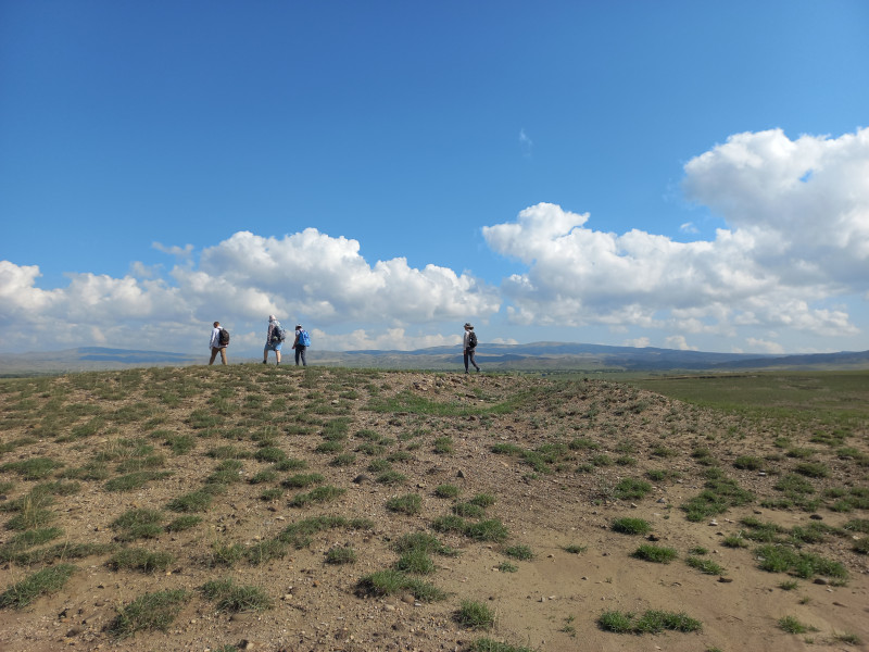
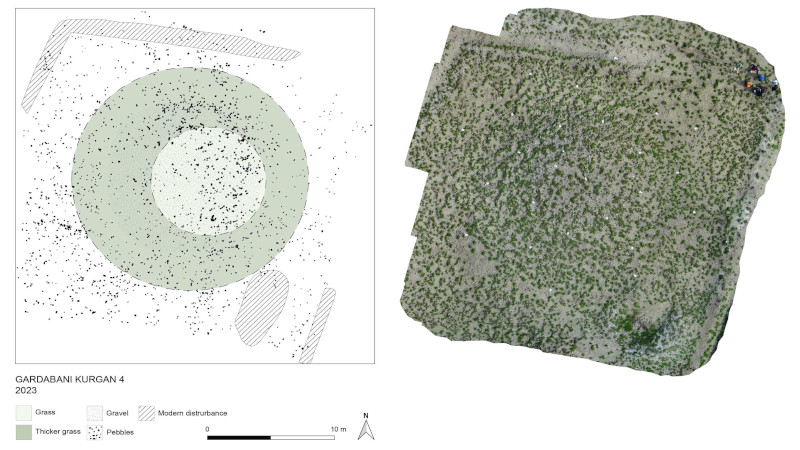
The kurgan field had been discovered a few years ago during an archaeological survey; our team had paid a first visit to it in October 2021. In the course of a preliminary field season in 2023 a total of sixty-three barrows and related archaeological features were geo-referenced and mapped.
The majority of the barrows are located in the southwestern part of the plateau. Their distribution throughout the area is not homogeneous and they seem to be grouped into separate clusters. The largest of these, composed of 27 barrows located rather close to each other, lies at the SE limit of the area. A second cluster lies ca 100 m to the NW of the first one; it is formed by 18 elements, also rather closely spaced.
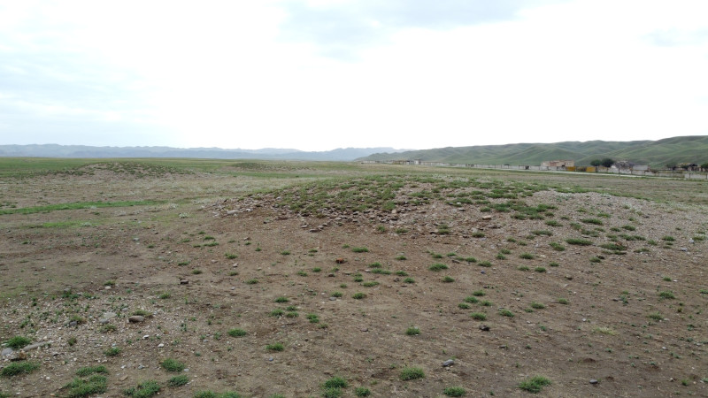
Kurgans are generally small (between 5-6 and 30 m in diameter) and rather low (less than 3 m in height). They had apparently been erected directly on the natural soil in an area devoid of any earlier or contemporary occupation and are covered with a thin and layer of sparse medium-and small-size river pebbles. Most of them appear to be well preserved and bear few evident traces of plundering, although some had been damaged by Soviet military installations. The top is often marked by a slight depression, possibly due to the collapse of an internal chamber. To judge from what is visible in the satellite images, some barrows may have been surrounded by a larger earthen mound or by an outer circle of stones.
There are no clear indications about the date of this remarkable funerary site, as no ancient material except for a few small obsidian flakes was found up till now on the kurgans or around them. Its proximity to the Late Chalcolithic cemetery of Soyuk Bulaq, which lies 15 km to the south just beyond the Azarbaijani border, might suggest a similar date at least for some of the barrows; alternatively, they might belong to any period between the Middle and the Late Bronze/Early Iron Age, when cemeteries composed of small kurgans were especially frequent everywhere in the Southern Caucasus.
Regular excavations at Gardabani kurgan field are planned to begin in summer 2024. The site represents a unique occasion to investigate a large funerary area through an integrated approach making use of different state-of-art analysis techniques. We plan to integrate the excavation of individual barrows with non-destructive investigations (remote-sensing and geophysical prospections) aiming to highlight the relations between different barrows, secondary burials and other possible auxiliary structures. The excavation will adopt a microarchaeological approach and large-scale sampling for bio-archaeological, archaeometric and paleo-environmental analyses will be carried out.
Gardabani Survey
The Gardabani Municipality extends over an area of 1,212.2 kmq from Tbilisi to the present border with Azerbaijan.
Our survey focuses only on the southern part of the region, south of the present city of Rustavi, between the valley of the Middle Kura River and the so-called “Coloured Mountains” of Mravaltskaro.
The region has never been the object of systematic surface investigations, although it has been preliminarily surveyed in recent years both by a Georgian team from Rustavi Museum and by the team of the Georgian/Canadian GRAPE project.
The area supposedly has a very high archaeological potential for pre-classical archaeology, since all the surrounding, and better explored regions yielded very important archaeological remains of different periods: the well-known Late Chalcolithic sites of Boyuk Kesik and Soyuk Bulak (Lyonnet et al., AMIT 40, 2008) lie just beyond its southern border, whereas the Iron Age site of Udabno (Korfmann et al. AMIT 35-36, 2005; see also S. Brodbeck-Jucker, “Die Keramik von Udabno und ihre Stellung innerhalb des früheisenzeitlichen Südkaukasus”, Bonn 2017) is located only 15 km to the east and, to the west, the Marneuli region is home to many different sites from the Neolithic to the Late Bronze period.
The landscape of the region is heterogeneous and comprises three different natural and geo-morphological environments.
Its western part is characterised by a wide lowland extending along the Kura river, which is now intensively cultivated and, in its northern part, heavily damaged by modern industrial infrastructures.
The entire valley is covered with grassland and patches of low forest and shrub are scattered all around, mainly along the course of the many irrigation canals.
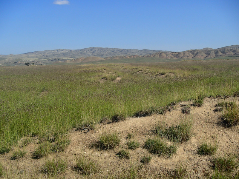
East of it, there extends a semi-desert area of smooth hills, completely devoid of trees, with an average altitude of ca 450 m a.s.l.
The kurgan field which will be excavated in 2024 by the Georgian-Italian team is located in this semi-desert area. No modern villages are present in this part of the region: in the Soviet period the land was used both for military purposes, as shown by the many still visible trenches, and for large-scale intensive cattle-breeding, which left the ruins of several farms, now only partially in use.
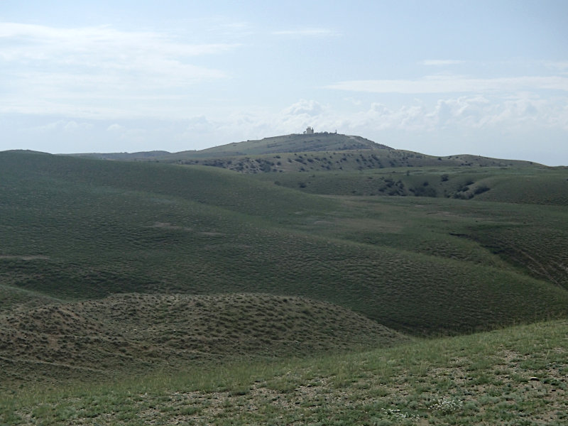
The eastern part of the region is characterised by the presence of low mountain ranges, the so-called “Coloured Mountains”. With a maximum elevation of ca 800 m a.s.l., these represent the natural border between Kvemo Kartli and Kakheti.
A preliminary visit to the area in Autumn 2023 highlighted the presence of some kurgan fields of unknown period and of a possible settlement of the LBA/EIA period.
The first season of systematic survey is foreseen to take place in Autumn 2024 by the GIGAP team in collaboration with Stefania Fiori and Alper Aslan (PhD candidates at Kiel and respectively at Torino University).
Thanks to the combination of ongoing remote sensing analysis, geomorphological research (responsible prof. G. Boschian) and extensive and intensive pedestrian survey, the expedition aims to map all the visible archaeological remains of the selected area in order to provide local authorities with a tool for its protection and valorisation and to reconstruct the development of human settlement in the region.
The survey also aims to clarify the relation between different sites (large and small settlements, necropolises, etc.), the diachronic development of the relations between human groups and the natural environment and between the local communities and those living in other regions of the Near East.